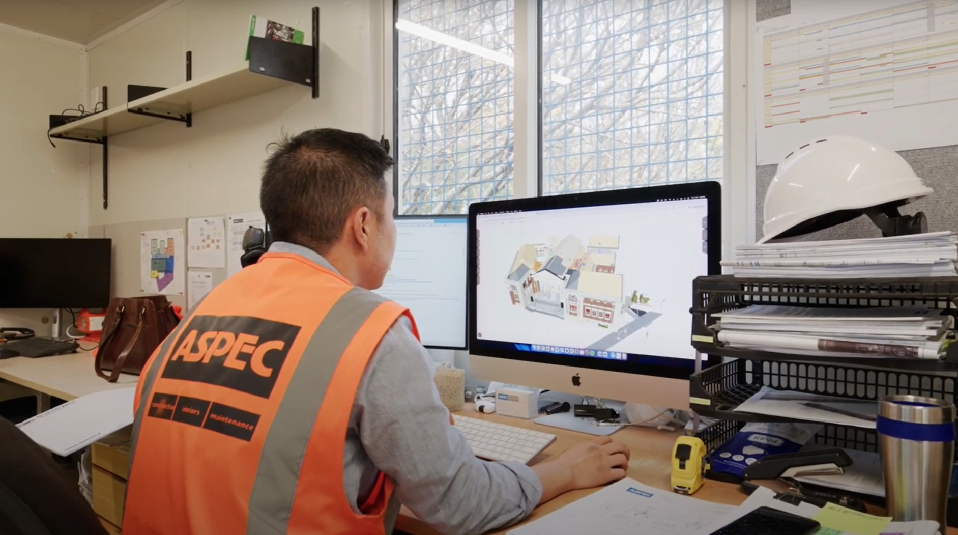
Designer | Reality capture for hazard identification
Description
Reality capture accurately captures and digitises existing site conditions using point cloud or photogrammetry technology, providing design teams with a comprehensive and precise representation of the project environment. By integrating this data with Building Information Modelling (BIM), designers can better understand and analyse potential site hazards, ultimately influencing their design decisions to enhance safety and efficiency.
The use of reality capture significantly reduces the need for site visits, thereby minimising exposure of staff to on-site risks. It also makes access to site information more easily available to the project team, allowing a wider range of stakeholders to virtually examine the site without physical presence. This broader access facilitates more thorough hazard assessments from various perspectives.
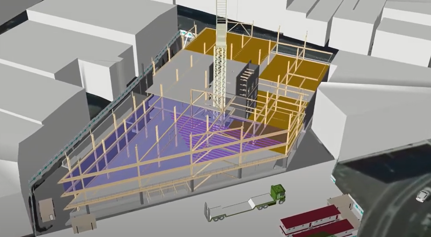
The integration of reality capture with BIM assists designers to create accurate and contextually relevant models. These detailed digital representations allow for early identification of potential clashes, spatial constraints, and safety concerns that might not be immediately apparent through traditional site surveys.
Case studies
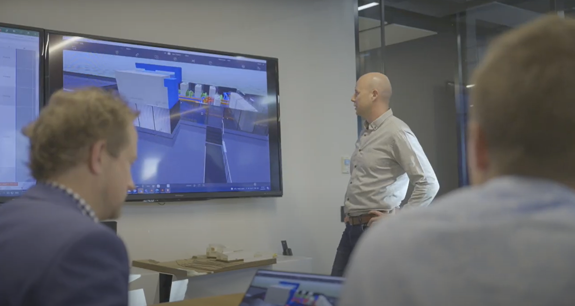
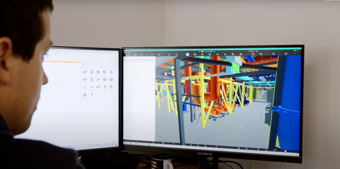
University of Auckland: Using BIM for Facilities Management safety planning
University of Auckland: BIM visualisation for Facilities Management
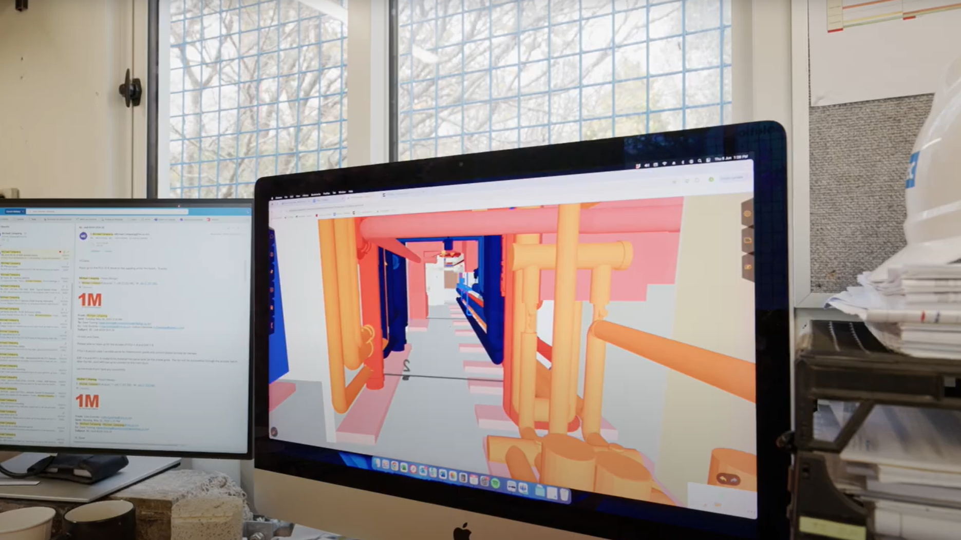
ACC Ōtepoti: Use of a 4D animation for planning
ACC Ōtepoti & Court Theatre: Use of BIM to improve site safety culture
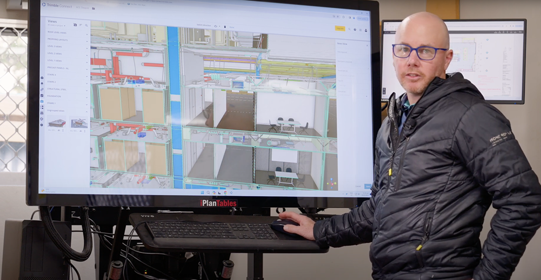
ACC Ōtepoti: Overlay of BIM model and reality capture using OpenSpace

Court Theatre: Creating a culture of collaboration

Court Theatre: Pre-planning for safer work
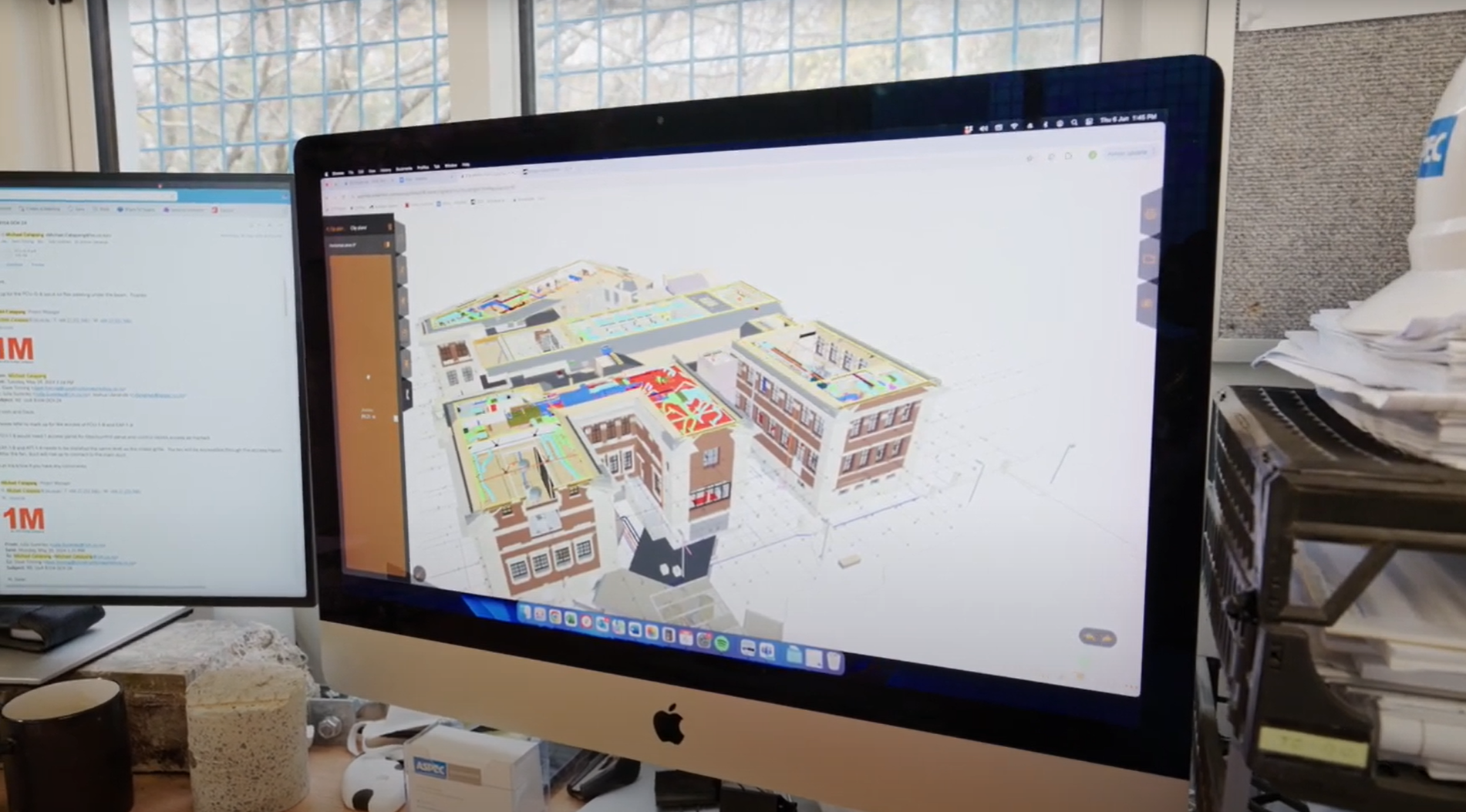
Dunedin Hospital Outpatients Building: Subcontractor modelling and prefabrication
ACC Ōtepoti: Contractor methodology design and hazard ID
Uses and benefits for health and safety
- Reduce risk by decreasing the need for site visits which may expose workers to site hazards.
- space
Other uses and benefits
- space
- Faster and more convenient access to the site by enabling teams to experience site conditions in a virtual representation.
- space
- Enable specialist consultants to remotely access site conditions from anywhere in the world.
Technology/techniques
Reality capture uses scanners, lidar and photogrammetry capture devices. The captured information is then transformed into useable file types and represented as 3D models.
Typically, the raw data can only be opened by the software supplied by the capture device vendor. Additional processing is usually needed to use the data in other software packages. Most model authoring tools can use some reality capture file types (for example, E57, RCS, LAS etc). There are also local and web-based platforms that can view this data.
For hazard investigation, viewing the reality capture information in a static state may be sufficient and a model authoring platform may not be needed.
Always consider the end-users of the data when specifying the file types for reality capture data.
Model/data requirements
Raw capture files usually contain a very large amount of data, but little metadata. It is recommended to focus on the following requirements:
- space
- Survey parameters – data should be correctly geolocated to link it with other model information.
- space
- File type – depends on software package used to access and view the information.
- space
- Point cloud density – reducing the scan density helps minimise the file size, provided it has sufficient accuracy to meet the project’s needs.
Hardware and software requirements
Data capture requires a laser scanner or a 360-degree camera. Specialised contractors offer reality capture services, so the organisation using the data need not own the scanning hardware.
To review and visualise reality capture data, the hardware and software requirements depend on the platforms that are available and how the team intends to share the data. For example, processing raw data may require a computer with more graphics and processing power.
If the reality capture data has been post-processed into either an online platform or visualisation tool, they can be handled by most modern computers, although a more powerful machine may still aid the process.
If the project team intends to view the raw data (or post-processed and opened locally), a software licence may be required (Autodesk Recap, for example). If the data is viewed through a web application, no additional software of licence may be required.
Contract/procurement implications
If reality capture for hazard identification is solely for use by the designer during the design stage of the project, the overall contract requirements in relation to the design team and client should not be affected. The cost of capture and processing may need to be negotiated. This should be weighed against the need for staff to visit site throughout the project to review the same conditions.
If the client requires the reality capture to be shared with contractor, specialist consultants, or other stakeholders, more consideration will be needed at the procurement stage. In this case, the purpose and format of the data should be explicit, with defined parameters, such as scan density or processing of scanned points into a model or image. A model description document should accompany the contract to communicate what the model information can be used and relied upon for [link to BIM Handbook].
Roles and responsibilities
| Surveyor/Site capture team |
Scans the site to capture the required information. This could be someone trained and licensed to fly a drone, or operate a point cloud scanner, etc. |
| Processing/Digital team |
Processes the raw data into a useable format for other teams. This may be carried out by the surveyor. |
| Design/Management team |
Responsible for reducing risk and communicating decisions on how to proceed on the project. They must know how to open and navigate the model. |
Training requirements
Using reality capture to make and communicate decisions depends on the capability of the team to access and interpret the data. Consider the following to encourage teams to actively make use of the data:
- space
- simple, documented workflows
- space
- explicit expectations on the use of the model
- space
- training champions assigned to help others use the tool.
Future directions
As the tools and platforms become more readily available and affordable for teams to use, reality capture is becoming more widely used. Specialist equipment and training is becoming less of a requirement, as iPhones can now capture similar information. The use of equipment such as robotic dogs, tracked or wheeled vehicles, or autonomous drones are all changing what is possible for reality capture, allowing sites to be accurately surveyed while reducing the need for workers to enter hazardous areas.