Designer | Reality capture for project communication
Description
Reality capture is a technology that uses laser scanners, drones or photogrammetry to create a 3D digital representation of the surrounding environment.
It can be used alongside BIM as a tool to record and communicate project specifics which may not be obvious to anyone unfamiliar with the site or project. Concerns that may otherwise be missed, such as power lines and other utilities, existing buildings, or site contours, can be captured and visually represented in the design process.
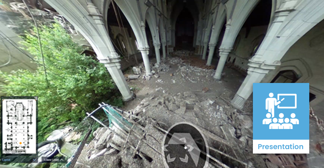
Designers often have limited opportunity to visit a site in the early stages of a project, so reality capture supports sharing of site information and hazards within the design team. This is particularly valuable on sites with specific health and safety challenges, such as earthquake-damaged buildings, where remote reality capture reduces the need for workers to enter potentially dangerous areas to carry out inspections or measurements.
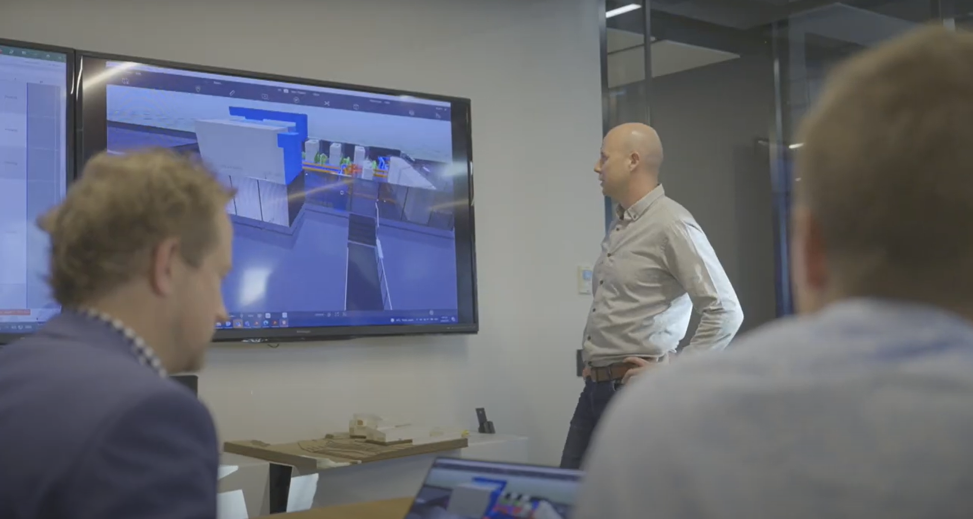
Site modelling, based on reality capture and BIM modelling of the evolving design, can be used as a communication tool between the client and design team. Being able to understand and communicate concerns and high-risk areas early in the project allows the team to mitigate and reduce potential harm in these aspects of the design.
On projects where public access or awareness is important, reality capture may support robust health and safety communication through public consultation.
Uses and benefits for health and safety
Provides accurate representations of existing site conditions and constraints.
Reduces the need for people to physically access the site, limiting their exposure to hazards.
Provides views of areas that are difficult or unsafe for people to access.
Enables non-technical people and those who prefer 3D visuals to understand and communicate hazards and issues that may be encountered.
Establishes a common source of information for all project participants.
Helps to identify the project’s intentions and approaches to increasing health and safety on site.
Technology/techniques
Reality capture requires some form of scanning technology, such as laser, lidar or photogrammetry capture devices. These may be hand-held or mounted on a robot, or a drone or other unmanned aerial vehicle (UAV).
These devices capture raw data which can be processed into a 3D model of the scanned area. Most model authoring tools can handle some forms of raw reality capture data, but typically the raw data can only be opened using software supplied by the capture device vendor. Using incompatible authoring software may require additional processing.
To simply see the data, a viewer tool may be an option. Viewer software is either installed on the user’s machine or accessed via one of several web-based platforms.
Using reality capture for project communication usually requires additional processing to integrate the data with an issues management platform, which may be standalone or web-based.
Model/data requirements
Raw capture files usually contain a very large amount of data, but little metadata. It is recommended to focus on the following requirements:
- space
- Survey parameters – data should be correctly geolocated to link it with other model information.
- space
- File type – depends on software package used to access and view the information.
- space
- Point cloud density – reducing the scan density helps minimise the file size, provided it has sufficient accuracy to meet the project’s needs.
When integrating a design model and reality capture data, the authoring tool may have additional data or processing requirements.
Hardware and software requirements
The hardware and software requirements depend on the tools used to review, visualise and communicate the reality capture data.
If the data has been post-processed into either an online platform or visualisation tool, the resulting files can be handled by most modern computers, although a more powerful machines aid the process.
If the project team intends to view the data using a standalone application, it may require licensing (like the Revizto tools, for example). If the data is viewed through a web application, no additional software or licence may be necessary.
Contract/procurement implications
Using reality capture for project communications generally requires the design team or client, or both, to agree on a platform. This typically comes with a cost component which would need to be considered if it is not in the supply chain’s existing software/platform stack. Such factors should be established early in the procurement process, ideally by explicit documentation through the Project Information Requirements and BIM Execution Plan.
The reality capture process may identify a hazard or safety concern that lies outside original scope of the project. If the design must deviate to resolve the problem, it may trigger a variation, which must be worked through by the client and design team.
Roles and responsibilities
| Surveyor/Site capture team |
Scans the site to capture the required information. This could be someone trained and licensed to fly a drone, or operate a point cloud scanner, etc. |
| Processing/Digital team |
Processes the raw data into a useable format for other teams. This may be carried out by the surveyor. |
| Design/Management team |
Responsible for reducing risk and communicating decisions on how to proceed on the project. They must know how to open and navigate the model. |
Training requirements
Using reality capture to make and communicate decisions depends on the capability of the team to access and interpret the data. Consider the following to encourage teams to actively make use of the data:
- space
- simple, documented workflows
- space
- explicit expectations on the use of the model
- space
- training champions assigned to help others use the tool.
Future directions
Issue management packages are increasingly used on projects to identify, classify and publish comments about the project to teams and stakeholders so they can make better decisions.
Teams often prefer these tools as they’re visual and relay the latest information from the model. Hazards and design mitigations can be given the same priority as traditional, email-based workflows, if the tools are used correctly.
Reality capture technology is becoming more accessible, with newer phones and tablets having lidar capability. Robots and UAVs are also increasingly available and cost effective.